

Following The Running Waves of the Caspian
by stanley greene
The Caspian Sea

“A poor fishermen casts his line out into the Caspian sea in Baku, Azerbaijan, while right across the Caspian in Turkmenistan, a duck hunter wades into the oil slicked sea. Both perched on a bounty of an estimated 200 billion barrels of oil and gas reserves hidden beneath the Caspian Sea”.
On the sea and waves of the Caspian, one can get carried far away, because the waves sneak up on you, they cannot be seen. I have always seen the Caspian as something to marvel and fear, especially the giant waves that can pull you down, deep down it’s darkest depth. Those who live and survive from what the Caspian offers believe that the sea is a giant lake but most of us, the visitors, believe it is a running sea that follows ships, laying hidden, coming up behind boats and ships. You do not see it coming till it hits you from behind and pulls you down, sinking the vessel, or the swimmer. The rule of thumb if you suspect you are being followed by a running wave, you have to move faster than it, or keep your distance to prevent from drowning.
The Caspian is a mixture of Nationalism, religious fanaticism and the region itself a greasy, bloody mess, money, power and oil dominate the future of the Caspian. Just like a running wave; if we do not pay attention, it could drown us.
On the farthest eastern reaches of Europe lies the Caspian sea bordered by Russia, Azerbaijan, Turkmenistan, Kazakhstan and Iran. The Caspian sea is a milky green land locked sea, that some geologists believe is a lake. Sea or lake, the Caspian hides many treasures.
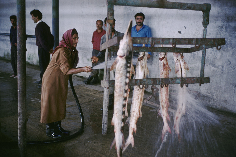
The Caspian is famous for its sturgeon and the sea is the world’s main source of Caviar. The Sea also sits upon vast reserves of oil and gas worth trillions of dollars.
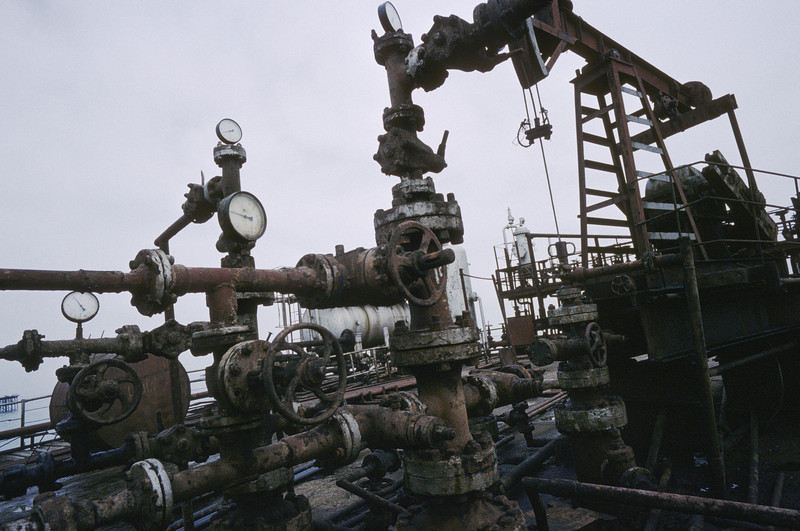
The wealth of the Caspian sea basin, perhaps one of the last great untapped source of energy on the planet, will make it of vital strategic importance in decades to come and crucial to European Prosperity in the next millennium.
The focus of oil in the Caspian goes very far back in its history, according to geologists “there has been oil beneath the Caspian and known for centuries”, the 13th century explorer Marco Polo reported that springs along the Caspian coasts bubbled with black goo that was good to burn. It literally bubbled straight out of the Earth. Natural gas that escaped through fissures in the rocky ground gave birth to one of the the world’s oldest religions, Zorasthrian fire worshippers, who built a temple around perpetual fire, burning now for thousands of years. The temple still stands today in what is now Baku, the capital of Azerbaijan.
- Stanley Greene, 2016
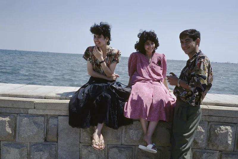
Azerbaijan
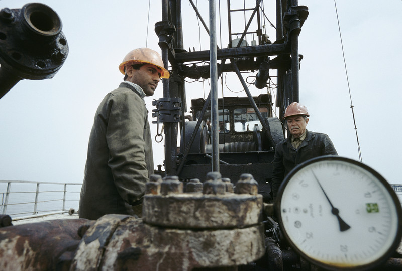

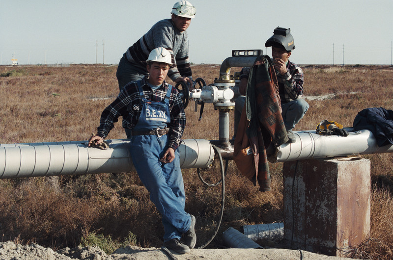
I spent a week in Azerbaijan reporting on the secret oil deals being cut poolside at the Hyatt Hotel in Baku for the New York Times Magazine in 1998. Bakusi what is now known as the wildest frontier of capitalism. From any window you can see (and smell) the rusted Soviet-style oil rigs rise in the smoggy distance, now the property of Western Consortiums.


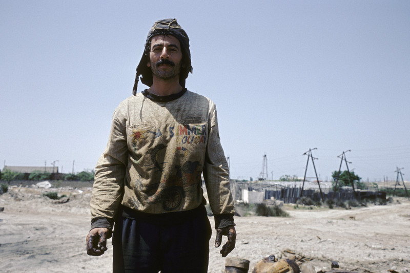

Smoke and pollution spew into the Azerbaijani atmosphere, only to rain down on poverty-stricken people who live within a 500 mile radius of the Caspian’s oil reserves making the region only second in strategic importance to the Persian Gulf.
Iran

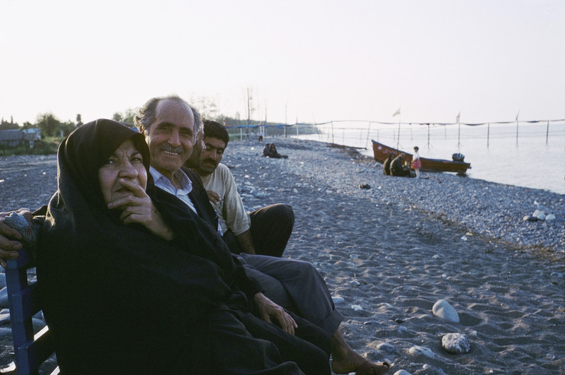
Caspian Iran is a beautiful region of Iran along the coast of the Caspian Sea. The forested coastal plains rise up quickly into the Alborz Mountains. This region is known in Iran for its beauty and its parks.


People from all around the country come there to experience much wetter and colder climate than the rest of the country.
All in all, it’s surroundings offer a starkly different experience from the rest of the country; Iran’s second face.

Kazakhstan
A central Asian country and former Soviet republic, extends from the Caspian Sea in the west to the Altai Mountains at its eastern border with China and Russia. Caspian Sea washes the western part of Kazakhstan. The name of the Sea is connected with the Caspii tribes who had settled shores from time immemorial. It had had such names as Girkanskoye, Khazarskoye, and Khvalynskoye. The first mentions about Caspian Sea and its tribes were in the works of Gerodot. The document about the Russian navigators’ visit of Caspian Sea and theirs boating is dated back to IX-X centuries. At the beginning of XVIII century Peter-I had begun the constant research of the Caspian Sea (expeditions of Bekovich-Cherkasky A. and others). Then Soimonov I.F., Ivashinsev N.A., Pallas P.S., Gmelin S.G., Karelin G.S., and others researched the Caspian Sea.


The Caspian Sea is stretched from north to south to 1200km; the medium width is 320km, the length of the shoreline is about 7000km (6000km of which in the territory of Russia and other countries). The area of waterland is 371000sqkm; the sea level is lower than ocean’s level to 28,5 (1971). The max depth is 1025m (in the southern part); the Kazakhstan part is not deep; the depth of the north Caspii is about 15-20m. The largest gulfs are: Komsomolets, Mangyshlaksky (Magystau), Kenderli, Kazakhsky, Kara-Bogas-Gol, etc. The total territory of the 50 islands is about 350sqkm. The rivers Volga, Ural and Emba flow into the Caspian Sea from the north side. By the bottom relief and hydrological features we can distinguish the Northern, the Middle and the Southern Caspii.
At the bottom of the Caspian Sea there are deposits of oil and gas.
The Caspian Sea crosses some climate zones: in the northern part – the continental, on the western – the temperate-warm, in the southwestern – wet-subtropical, on the east – dry-steppe zone. The northern part differentiates by the sudden changeability of the air temperature and insufficiency of atmospheric precipitation. In the northern and middle parts in October-April the wind blows from the east, in May-September the monsoon wind blows from the north-western part to the south, on the eastern middle parts, in the north-western and north parts there are such winds the speed of which exceeds 24m/s. Average temperature of July and August is +24+26’C, the absolute maximum is +44’C on the east. In winter months the temperature changes from –10’C in the north and to –12’C in the south. About 200mm of atmospheric precipitation fall over the Sea. Average value of evaporation is 1000mm per year. Average temperature of the water surface is +24+26’C in summer, in the southern part is +29’C. Average temperature of the water in the north is –0,5’C in winter, in the middle part from –3’C to –7’C, and in the south –8-10’C. In the north the water surface freezes from November to March, the ice is 2m thick. Average water salty is 12,7-12,8%, on the eastern coast is 13,2%, in the closest parts of Volga and Ural mouth is 0,1-0,2%.


The sea level sometimes rises to 2-2,5m and falls to 2m. The total season fluctuation is about 30cm. It is known, that the lowest sea level was in VII-XI centuries (to 2-4m lower than nowadays). The last falling of the sea level continued from 1929 to 1057. The falling of the sea level is the result of dry climate, and the building of the largest hydrotechnic and irrigation buildings on the river. Flora and fauna of the Caspian Sea are comparatively poor. More than 500 kinds of plants, 854 kinds of fishes and animals, some kinds of aquatic birds dwell here. There are large populated areas near the Caspian Sea such as: Guriev, Shevchenko, Eraliev, Balykshy, Ganushkino, etc and important economic regions.
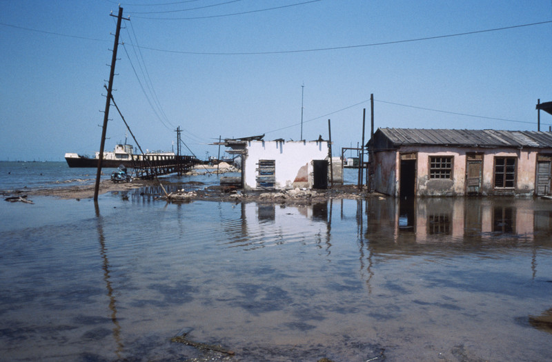
Chechen Island, Russia
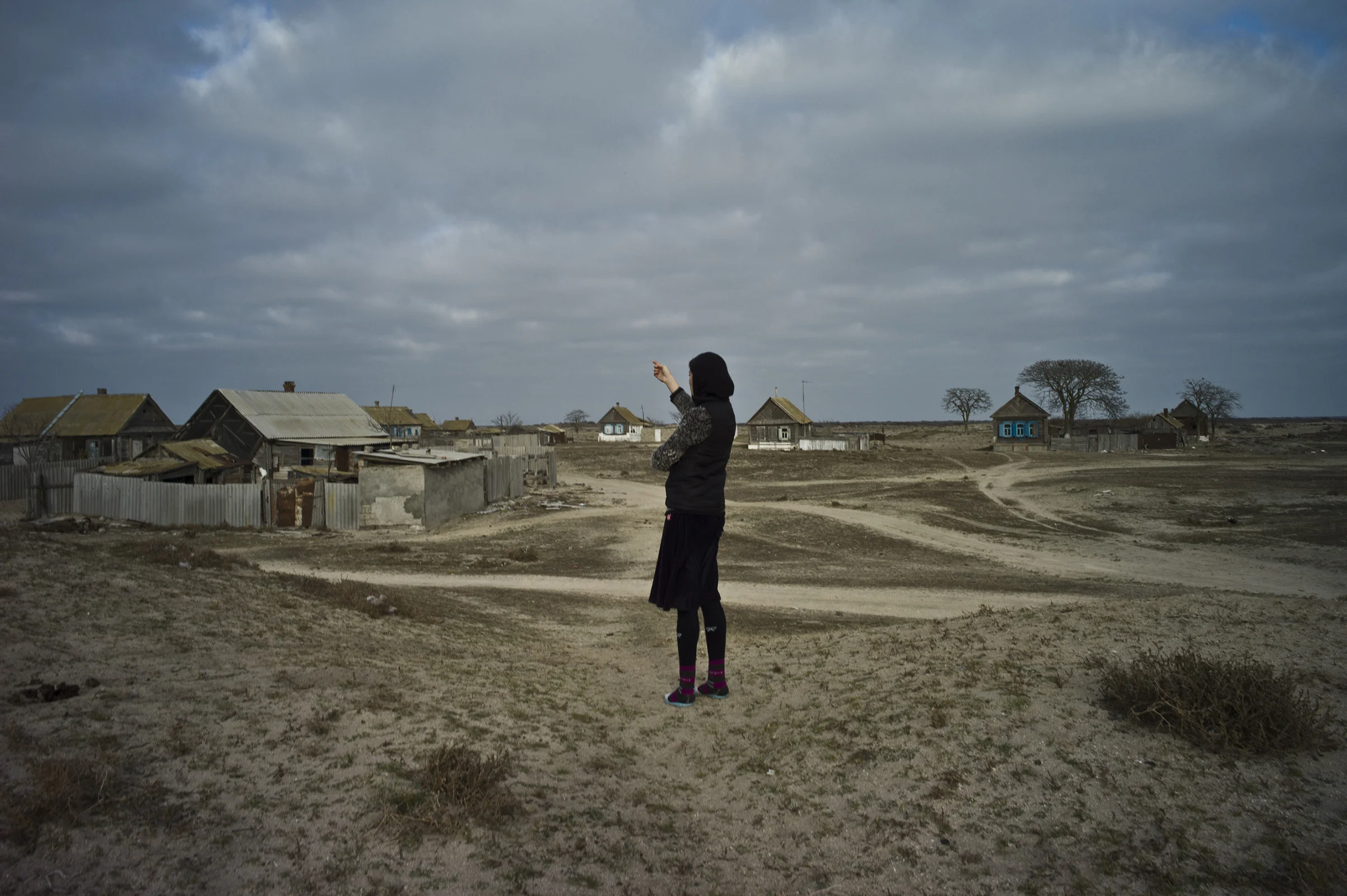
Long ago the island was used for Chechen Prisoners that fought in the Caucasus with the Czars. After their release a few stayed on the island but they became difficult and wanted to return to the mountains. Some were deported to Kazakhstan; others were drowned in the sea. The island is a mystery of actually what happened to the Chechens.
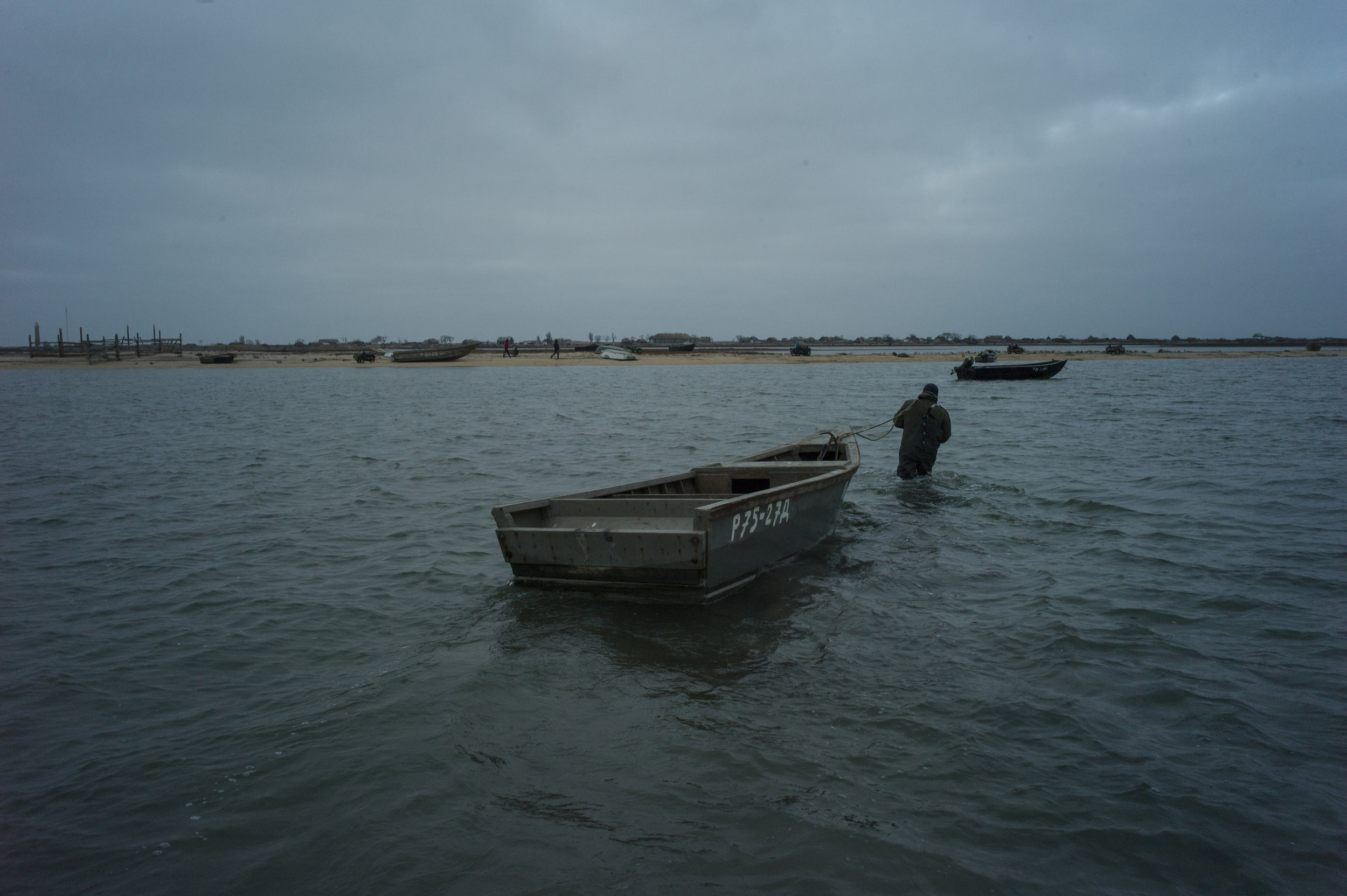

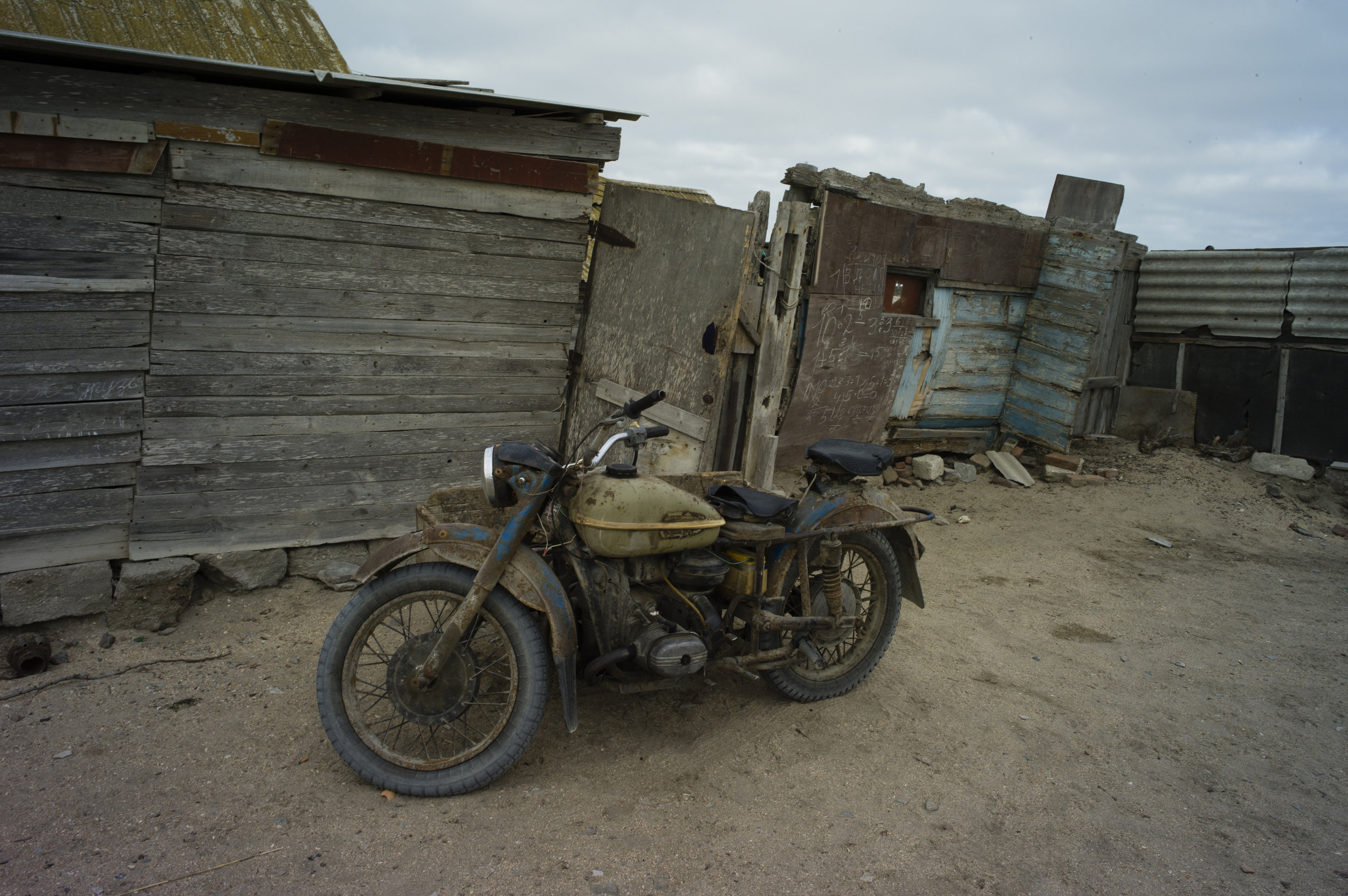

In 1964, the island was used for testing of a plane that could take off from the water. It was closed to the public from 1964 – 1982. Photographs from American spy satellites showed a strange aircraft carrying letters “KM” on its fuselage. CIA disambiguated it as “Kaspian Monster” but it actually meant “Korabl maket”. The chief designer was Rostislav Alexeyev and in 1982 pilot error caused a crash. The plane was too heavy to be recovered from its watery wreck site. By then the economy was completely destroyed, and only people with nowhere to go stayed. Fishing was the only industry but it was later semi banned by the Russian government for over fishing. Now the island has only a few residents, and they say they are dying like the Island.
Turkmenistan
More than 20 years since the break-up of the Soviet Union, the five Caspian coastline states have disagreed on how the energy resources under the seabed should be shared, developed and managed. Turkmenistan is one of the players in the region, but it is such an iconic secret society that being able to get there is quite challenging.


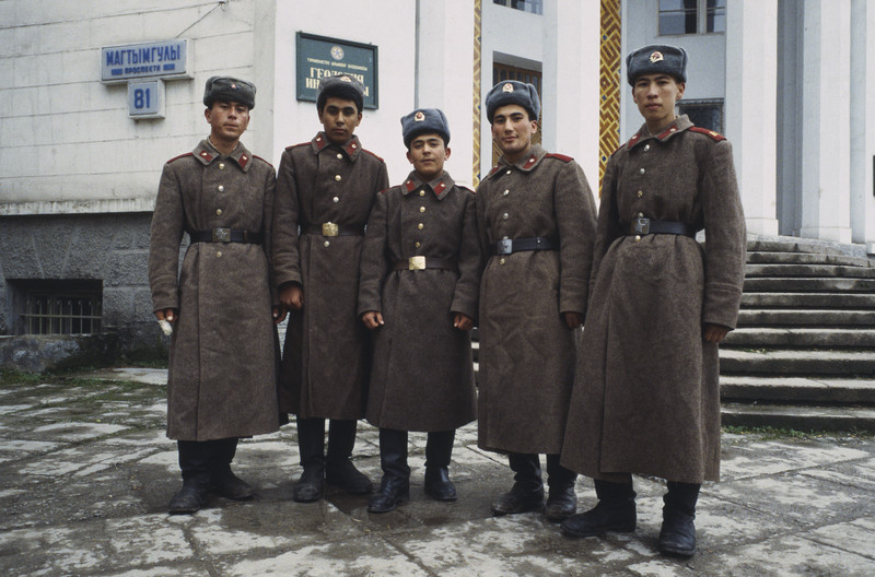

In 1994 I traveled there by boat, which at the time was not possible for foreigners, but my arrival caught them completely off guard, they allowed me and my colleague to stay and work there for a period of a few weeks also their leader Turkmenbashi was in America for and operation concerning some vital organs.
- Stanley Greene